FDEM - Pre-Disaster Digital Mapping
To document pre- and post-disaster conditions, the Florida Division of Emergency Management (FDEM) is deploying a survey team (DebrisTech) to document all roads with unrestricted access in your county. The resulting documentation will establish a supplemental source of visual evidence of current conditions of roadways, signs, vegetation, etc., that could be damaged due to an event such as a hurricane.
FDEM has tasked a DebrisTech vehicle and driver with completing the documentation. If the driver is on a private road with restricted access or that is not open to the public, please allow the driver to return to a roadway that is open to public access.
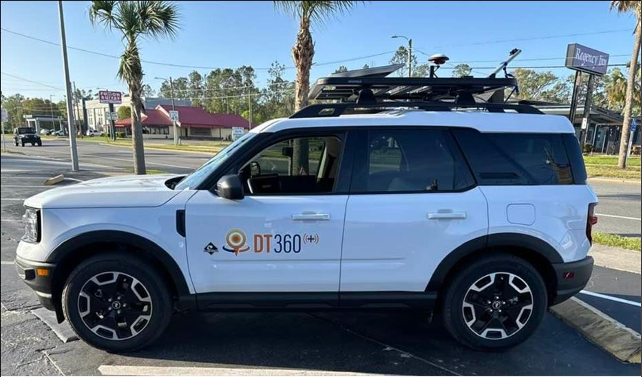
The vehicle will survey roads in Florida with a 360-degree camera and LiDAR. Below is an image of one of the vehicles (color may vary) that will potentially drive our county roads over the next several weeks to months as we schedule operations in our area.
The County Emergency Management Department is aware of this task and can confirm that this is a sanctioned operation led by FDEM. If you have any questions or concerns, please contact the FDEM Point of Contact, Ashley Mitchell, at (850) 566-0617 or ashley.mitchell@em.myflorida.com.

